Category Archives: Lost

Lost

Daleside

NGR: SE 526894 (High Buildings)

At present there are no known, enterable holes in this area however the area would appear to have considerable potential as noted in the following extract from M.S.G. 7:

“To return to the “classic” windypit area, the farmer at Daleside, i.e N. side of Gowerdale, complained recently that in the vicinity of High Buildings, he no sooner fills in one windypit than another one opens up! Those at present detectable overlook Coomb Hill, are full of rubbish, and too narrow anyway.”

Wrelton Hole

Moorland Caver (2003)

Noted by Raymond Hayes: “A similar hole (i.e similar to the hole found at Swinsty Farm (q.v)) was reported from Wrelton (3 miles west of Pickering). This was filled up with thorns and rubbish, by a farmer, who had a horse almost engulfed in it many years ago. There was a short passage from the bottom. The hole was about the same dimensions as that at Pickering.”

Troutsdale Windypit

Moorland Caver (2003)

NGR: SE 929879
Altitude: 220m
Length: 2.5m
Depth: 10m

During logging operations, a forestry tractor wheel broke into the rift, unfortunately, due to its location in the track, the hole had to be quickly surveyed and filled in. Whilst surveying, a farmer informed us of another hole that had opened up some years previously. It was 50m further along the track, along the same fault line and had been much larger. It was filled in at the time of discovery and sadly, no records were taken however this area could repay more attention and reveal its secrets. It is obviously much larger

mc-trout

Swinsty Farm Hole (Swainsea)

Moorland Caver (2003)
Examined by Raymond Hayes in 1943: “I was shown a peculiar hole in a field at Swinsty Farm 1 mile NW of Pickering. It was a circular pit about 12 or 15 feet wide and 10 feet deep. Passages leading off were blocked by earth. I was told it was an old watercourse and someone had explored one of the three passages but had to return because of foul air. The district is on rising limestone ground and to the east are extensive quarries which we examined for caves and found none.”

Spaunton Cave

Moorland Caver (2003)
Altitude: 130m
Length: Circa 21 m
Access: Recent attempts to regain access to this cave have not proved successful. Please do not approach the farmer on whose land the cave lies as this could compromise any future access.

The cave was explored and described by Paul Fitton in 1948/9. As this cave has not been accessible or, indeed, open since the late 1940s (when the entrance was back-filled) it is worthwhile to record Fittons description in full:
“The entrance shaft descends through 6 feet of loose earth and gives the impression that it is party (sic) of a much larger rocky opening which has become completely blocked by soil. The floor is composed of sandy clay, which has evidently run in from the entrance, and a certain amount of excavation was necessary before the original explorers could follow the passage. The roof is a flat bed of limestone and shows little trace of water action. The cave comes to an end in a constricted passage, which is completely blocked by a fall of roof.
It seems possible that excavation might reveal a continuation of the passage on the opposite side of the entrance shaft.
The cave is very reminiscent of Kirkdale, Fadmoor and other caves in the area …”

History
Entrance collapsed under the weight of a farm trailer in September 1948. The cave was explored and surveyed on 7.11.1948 by R. Hayes, J. Bridge and E.P Fitton.

Nunnington Railway Cutting

Moorland Caver (2003)

Discovered late 1860s / early 1870s during the construction of a railway cutting through the Caulkless Spur. Continuing work during the construction of the cutting obscured the cave. The cave consisted of a large chamber with a strong draught. Three fissures led off, one apparently containing a pitch with the sound of running water beyond. It is likely that the main chamber was quarried away during further work in the cutting; however the possibility remains that the fissures survive.

Nunnington

King Alfreds Cave

Moorland Caver (2003)
NGR: SE 89828328
Alt: 100m
Length: Unknown at present.
Access:` Permission to descend is not granted.

In 708 Ad, a great battle took place at Ebberston. Alfred the Saxon King of Northumberland fought at the front until he was pierced with an arrow and whilst lying wounded and defenceless on the floor, he was speared in the thigh. During the night he was taken to a cave to rest and later moved to Driffield where he died from his injuries. He was buried in a local church
In 1770 a cairn was built on the hilltop just above the cave to commemorate the event.

History
Excavated by W.H.Lamplough and J.R.Lidster in 1950-1
Remains of seven humans (5 adults, 2 children) were found along with Flints, Pottery, Antler and Animal bones. These are assumed to be Early Neolithic although no carbon dating was done and all remains are now missing or lost. After the excavation, a large boulder was levered over the entrance effectively sealing it forever.

Thomas Hinderwell ‘History and Antiquities of Scarborough and the Vicinity (1798)

Upon the hill, above the house, is a small Cave, in a rock, called by the country people Ilfrid’s Hole; they inform the inquirer, from tradition of their ancestors, that a Saxon King of that name, being wounded in battle, fled from his pursuers, and took shelter in this cave, where he remained one night, and was next day conveyed to Driffield.

The following inscription, which was upon a stone over the Cave, and afterwards painted upon wood when the stone decayed, is remembered by some of the ancient inhabitants.

“Alfrid, King of Northumberland, was wounded in a bloody battle near this place, and was removed to Little Driffield where he lies buried: hard by, his entrenchments may be seen.”

An inclosure at the west end of Ebberston, adjoining the Pickering road, now known by the name of Bloody Close, strongly indicates that a battle has been fought there; but the tradition is, that Alfrid was wounded in a battle within the lines of Scam-ridge, (either Six Dikes, or Ofwy’s Dikes) near this place.

This Cave is now almost filled up by the falling in of the rock ; but several of the old people of the village remember when it would have contained eight or ten persons.

*Corrupt name for Alfrid’s Cave.
Greencliffe Hag

Moorland Caver (2003)

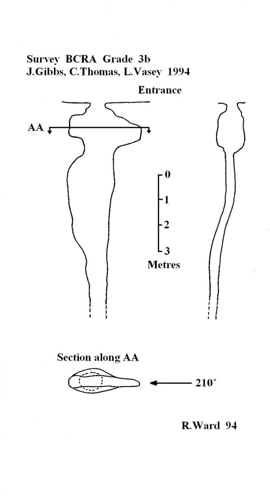
Small hole, completely choked with sheep carcasses, noted by Dr. Paul Fitton in 1949. The hole had been known to Duncombe Park keepers for a number of years and was used by local farmers for dumping carcasses (a traditional use for windypits and one that is still on going).
Various, unsuccessful, attempts have been made to locate Greencliff Hag (most recently by the current author in 1996) and it must be assumed that it is truly one of the lost windypits of Ryedale.

BCRA Transactions – Vol.3 No.2 – The North Yorkshire Windypits (1976)BCRAT3-greencliffe