Moorland Caver (2003)
NGR:SE 708865
Altitude: 50m
Length: 45m
Depth: 20m
Access: Ravenswick Estate
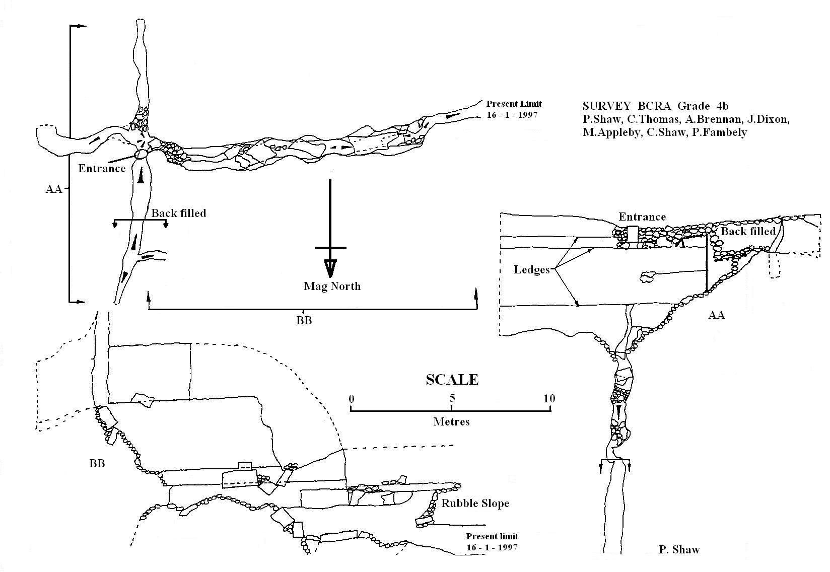
Grade: II
Entertainment value: II
Warning Tread carefully, large numbers of small lizards have been found at the bottom of the entrance rift.
Hole is located a short way up the footpath leading off from the lane down to Yoadwath.
Oil drum entrance covered by a substantial slab (replace). The entrance drops directly into the top of a narrow rift the upper sections of which are somewhat loose (care).
The rift can be descended without tackle, however a handline (belay to nearby tree) is useful for the return. A landing is made at the intersection of rifts at right angles to each other. North was tight and blind but is now backfilled; heading South is impossibly tight and pinches up after 5m. East has a tight entrance into a widening rift that continues for 5m to a choke which hasn’t been pushed.
The way on is West, dropping through a very tight slot in the floor and descend into widening rift (circ 40cm) to extreme dodgyness. Crawl under boulder choke into area of hanging boulders and gravity defying rubble slope. A small excavated crawl in the choke underneath the rubble slope marks the present limit of exploration (16-1-97)
Tackle
Entrance: 8m handline (optional), belay to nearby tree.
History
Entrance opened during the construction of new track, explored by S.C.C. in 1996.